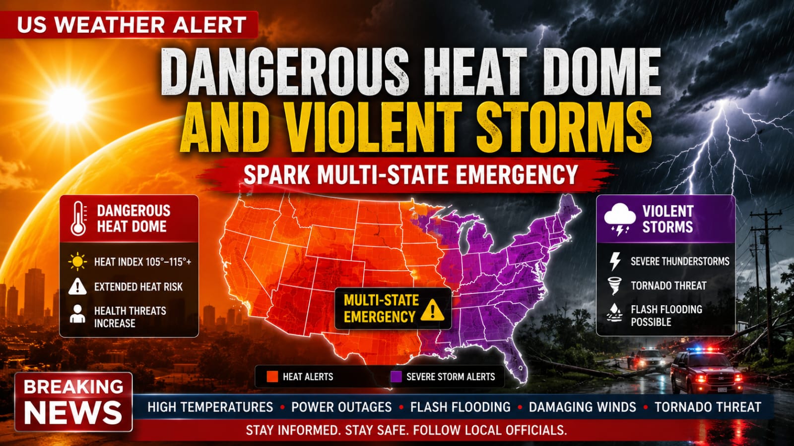
WASHINGTON, D.C. — A massive and complex weather pattern is gripping the United States this week, prompting the National Weather Service (NWS) to issue concurrent warnings for dangerous heatwaves and violent, destructive thunderstorms. A building summer heat dome is locking intense, humid air across the Southern Plains, Midwest, and East Coast. Simultaneously, a series of clashing cold fronts tracking across northern regions is triggering explosive atmospheric instability, creating a dual-threat emergency for millions of Americans.
In the central U.S., meteorologists have issued widespread Heat Advisories across major metropolitan corridors, including east-central Kansas and west-central Missouri. A powerful ridge of high pressure is drawing thick, tropical moisture up from the Gulf of Mexico, sending afternoon heat index values soaring to 105°F and higher. Public health officials are expressing deep concern over elevated overnight low temperatures, which are failing to drop below 75°F to 80°F in urban centers. This lack of nocturnal cooling prevents metropolitan infrastructure from naturally shedding heat, significantly compounding physical heat stress on the human body over consecutive days.
Further north and east, the transition into summertime heat is sparking severe turbulence as hot air masses collide with northern cold fronts. In regions like southeastern Michigan and southern Wisconsin, weather models show rapidly building atmospheric instability. While initial daytime hours have provided brief stretches of sunshine, powerful low-pressure systems are moving in during the late afternoon and evening hours. Forecasters warn that these clashing fronts will generate scattered but highly intense thunderstorm cells capable of altering regional travel and safety in a matter of minutes.
The primary threats within these storm zones are torrential downpours and severe straight-line winds. Meteorological reports indicate that training storms—cells that repeatedly move over the same geographical footprint—are dumping rain at staggering rates of 2 to 3 inches per hour. This intense rainfall volume is causing rapid water accumulation, leading to immediate flash flooding, dangerous road ponding, and severely compromised visibility. Concurrently, localized wind gusts of 35 to 40 mph are threatening to down weakened tree limbs and disrupt regional power grids.
With emergency rooms tracking an expected early-season spike in heat-related admissions, municipal authorities are urging residents to review critical safety and survival protocols. Health departments emphasize the importance of distinguishing between heat exhaustion—marked by heavy sweating, dizziness, and a weak pulse—and heat stroke, a life-threatening medical emergency characterized by confusion, a strong rapid pulse, and a body temperature spiking above 103°F. Residents in high-heat zones are strongly advised to reschedule strenuous activities to early morning hours, maximize fluid intake, and never leave children or pets inside parked vehicles.
Looking ahead, meteorologists expect this volatile, split-weather pattern to persist through much of the week as the strengthening Bermuda high-pressure ridge stabilizes over the eastern half of the country. While the clashing northern fronts will provide brief, fleeting temperature drops to parts of the Midwest, the core heat dome is projected to expand and intensify, pushing afternoon highs toward the upper 90s by the weekend. Emergency management agencies recommend that all communities within the active impact zones continuously monitor local radar updates and maintain multiple methods for receiving urgent weather alerts.